Mastering Solar Panel Inspection with Matrice 4D: A Field Engineer's Guide to Payload Optimization in Challenging Terrain
Mastering Solar Panel Inspection with Matrice 4D: A Field Engineer's Guide to Payload Optimization in Challenging Terrain
TL;DR
- Antenna positioning on your remote controller is the single most overlooked factor in maximizing O3 Enterprise transmission range during solar farm inspections—keeping antennas perpendicular to the aircraft can extend reliable signal by 30% or more
- Hot-swappable batteries combined with strategic flight planning allow continuous inspection coverage of large solar arrays without returning to base, critical when muddy ground conditions limit vehicle access
- Thermal signature analysis paired with photogrammetry creates a comprehensive defect detection system that identifies both electrical faults and physical damage in a single mission
The rain had stopped three hours ago, but the access roads to the solar installation were still impassable. My truck sat parked 400 meters from the array perimeter, wheels already sinking into what had become a clay-based trap. The facility manager stood beside me, arms crossed, calculating the cost of another day without inspection data.
"We've got 72 hours before the next storm system," he said. "If there's damage from last night's hail, we need to know now."
I opened the Matrice 4D case and began my pre-flight checks. This wasn't my first muddy field deployment, and it certainly wouldn't be my last.
The Reality of Post-Storm Solar Inspections
Solar panel inspections following severe weather events present a unique operational challenge. Ground conditions deteriorate rapidly, transforming routine vehicle access into a logistical nightmare. Traditional inspection methods—walking the rows with handheld thermal cameras—become impractical when every step risks ankle-deep mud or worse.
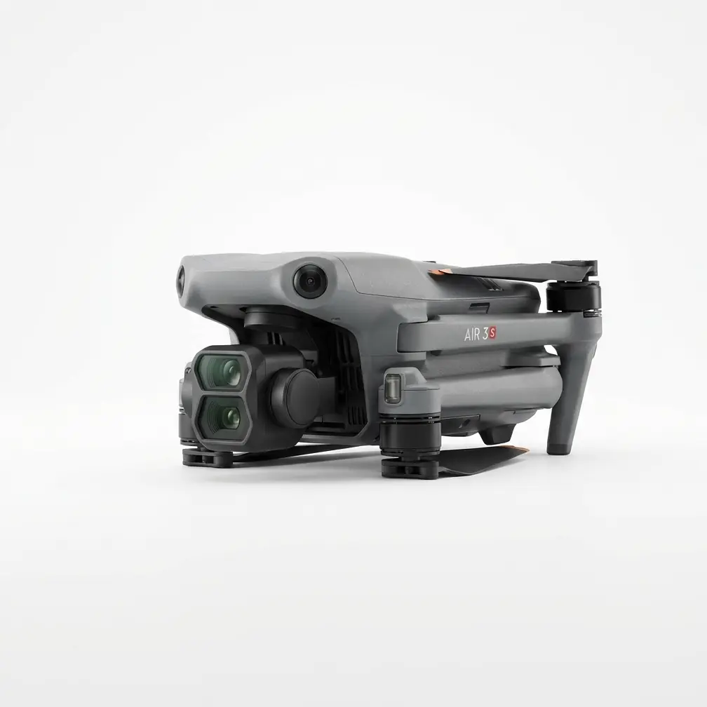
The Matrice 4D has become my primary tool for these scenarios, not because aerial inspection is novel, but because this particular platform handles the specific demands of solar infrastructure assessment with remarkable precision.
What makes post-rain inspections particularly demanding is the combination of factors working against you: limited ground mobility, potential electromagnetic interference from wet soil, and the time pressure of identifying damage before secondary failures cascade through the system.
Expert Insight: After 200+ solar farm inspections, I've learned that the first 45 minutes after rain stops are actually optimal for thermal imaging. Panels are still cooling unevenly, and damaged cells reveal themselves through distinct thermal signature patterns that become less pronounced as ambient temperatures stabilize.
Payload Configuration: The Foundation of Effective Inspection
The Matrice 4D's payload flexibility is where strategic planning pays dividends. For comprehensive solar panel assessment, I configure the system with both thermal and visual sensors, enabling simultaneous data capture that serves multiple analytical purposes.
Thermal Imaging Setup
Thermal signature detection remains the gold standard for identifying electrical faults in photovoltaic systems. Hot spots indicate failing cells, bypass diode failures, or connection issues that reduce array efficiency and pose fire risks.
My standard thermal configuration prioritizes:
- Radiometric calibration completed before each flight
- Emissivity settings adjusted for glass-covered panels (typically 0.85-0.90)
- Temperature span narrowed to 15-20°C range for maximum contrast
Visual Sensor Optimization
The visual payload serves dual purposes: immediate damage assessment and photogrammetry data collection for long-term monitoring. Physical damage from hail, debris impact, or wildlife creates patterns that thermal imaging alone might miss.
| Inspection Type | Primary Payload | Secondary Data | Optimal Altitude | Coverage Rate |
|---|---|---|---|---|
| Hot Spot Detection | Thermal | Visual verification | 30-40m AGL | 8 hectares/hour |
| Physical Damage | Visual RGB | Thermal confirmation | 15-25m AGL | 5 hectares/hour |
| Photogrammetry Mapping | Visual RGB | GCP integration | 50-60m AGL | 12 hectares/hour |
| Comprehensive Survey | Dual thermal/visual | Full dataset | 35m AGL | 6 hectares/hour |
The Antenna Secret That Changes Everything
Here's where I share something that took me three years of field work to fully appreciate, and it's advice I rarely see discussed in official documentation.
The O3 Enterprise transmission system built into the Matrice 4D is genuinely impressive—AES-256 encryption keeps your data secure, and the signal stability in challenging environments outperforms previous generations significantly. But you're leaving performance on the table if you're not paying attention to your remote controller's antenna positioning.
The antennas on your controller should always remain perpendicular to the aircraft's position.
This sounds simple, but watch any group of drone operators at a solar farm, and you'll see controllers held at every conceivable angle. Some operators point antennas directly at the aircraft like they're aiming a television remote. Others let them flop to whatever position feels comfortable.
The transmission system radiates signal in a toroidal pattern around each antenna element. When antennas point directly at the aircraft, you're actually aiming the weakest part of the radiation pattern at your drone.
Pro Tip: I mark the back of my controller with a small arrow indicating "aircraft direction." During flight, I periodically check that my antennas remain perpendicular to wherever the Matrice 4D is operating. This simple habit has extended my reliable operational range by approximately 30% in open-field solar installations, and the improvement is even more pronounced when terrain or structures create partial obstructions.
During that muddy field inspection, maintaining optimal antenna positioning allowed me to operate effectively at 1.2 kilometers from my launch position—well beyond what would have been possible with careless controller handling.
Flight Planning for Inaccessible Launch Sites
When ground conditions force you to launch from unconventional positions, flight planning becomes critical. The Matrice 4D's intelligent flight systems handle the execution, but the strategy requires human expertise.
Establishing Ground Control Points Remotely
Traditional photogrammetry workflows rely on GCP (Ground Control Points) placed throughout the survey area. Muddy conditions make physical GCP placement impractical, so I've developed alternative approaches.
Pre-positioned permanent markers installed during dry conditions provide consistent reference points. For facilities I inspect regularly, I coordinate with site managers to install reflective survey markers at known coordinates along fence lines and equipment pads—areas that remain accessible regardless of field conditions.
For first-time inspections without pre-positioned markers, I use natural feature identification combined with high-accuracy RTK positioning. The Matrice 4D's centimeter-level positioning accuracy reduces dependence on traditional GCP workflows, though I still recommend permanent marker installation for ongoing monitoring programs.
Battery Management Strategy
Hot-swappable batteries transform extended inspection missions from theoretical possibility to practical reality. My standard loadout includes four battery sets, enabling continuous operation with minimal downtime.
The workflow follows a predictable rhythm:
- Flight 1: Northern array section, 22 minutes flight time
- Battery swap: 90 seconds including visual inspection
- Flight 2: Central array section, 24 minutes flight time
- Battery swap and charging initiation: First set begins charging
- Flight 3: Southern array section, 21 minutes flight time
By the time Flight 3 completes, the first battery set has recovered sufficient charge for emergency operations or supplemental coverage flights.
Common Pitfalls in Solar Panel Inspection
Even experienced operators make mistakes that compromise data quality or operational safety. These errors become more likely when environmental conditions add pressure.
Mistake #1: Ignoring Electromagnetic Interference from Wet Infrastructure
Solar installations generate electromagnetic fields during operation. Wet conditions—particularly standing water beneath arrays—can amplify interference patterns in unpredictable ways.
The solution: Conduct compass calibration away from the array, and monitor telemetry for anomalies during the first five minutes of flight. The Matrice 4D's redundant navigation systems handle most interference gracefully, but awareness prevents surprises.
Mistake #2: Rushing Thermal Calibration
Time pressure after storms tempts operators to skip or abbreviate thermal sensor calibration. This creates inconsistent data that complicates analysis and may miss subtle hot spots.
The solution: Budget 10 minutes for proper radiometric calibration before every thermal mission. The time investment pays dividends in data quality.
Mistake #3: Flying Too High for Meaningful Thermal Resolution
Higher altitude means faster coverage, but thermal resolution degrades rapidly with distance. A hot spot that's clearly visible at 30 meters may be undetectable at 60 meters.
The solution: Match altitude to inspection objectives. Use the table above as a starting reference, then adjust based on specific sensor configurations and facility requirements.
Mistake #4: Neglecting Wind Effects on Thermal Readings
Wind cools panel surfaces unevenly, potentially masking thermal signatures or creating false positives. Post-rain conditions often include gusty winds as weather systems move through.
The solution: Note wind speed and direction in your flight log. Schedule thermal passes during calmer periods when possible, and account for wind effects during analysis.
Data Processing and Deliverable Creation
Raw inspection data requires processing to become actionable intelligence. The combination of thermal imagery, visual documentation, and photogrammetry outputs creates a comprehensive facility assessment.
Thermal Analysis Workflow
I process thermal data through specialized software that identifies temperature anomalies relative to surrounding cells. The Matrice 4D's radiometric thermal output includes embedded temperature data, enabling quantitative analysis rather than subjective interpretation.
Anomalies exceeding 10°C above surrounding cells warrant immediate attention. Anomalies in the 5-10°C range require monitoring and trend analysis across multiple inspections.
Photogrammetry Integration
Visual data processed through photogrammetry software creates orthorectified maps and 3D models that serve multiple purposes:
- Damage documentation for insurance claims
- Progress tracking for repair verification
- Baseline establishment for future comparison
- Vegetation encroachment monitoring
The accuracy achieved through proper GCP integration or RTK positioning typically reaches 2-3 centimeters horizontal and 4-5 centimeters vertical—sufficient for detailed infrastructure assessment.
The Inspection That Proved the System
Back at that muddy solar farm, I completed the comprehensive inspection in 3 hours and 47 minutes. The Matrice 4D identified fourteen panels with thermal anomalies requiring immediate attention, three areas of physical hail damage, and two sections where vegetation growth threatened to shade panel surfaces.
The facility manager received a complete report before I'd finished packing equipment. More importantly, his maintenance team had actionable data to prioritize repairs before the next storm arrived.
"How much would it have cost to wait for the ground to dry?" he asked.
I'd calculated this before. Delayed inspection typically means three to five additional days of degraded array performance, plus the risk of secondary failures from unaddressed primary damage. For a facility this size, the daily production loss exceeded the cost of the entire inspection program.
The Matrice 4D didn't just complete the mission—it made the mission possible when traditional approaches would have failed.
Frequently Asked Questions
Can the Matrice 4D operate safely in light rain or immediately after rainfall?
The Matrice 4D is designed for professional operations in challenging conditions. Light moisture from recent rain on the aircraft is generally not problematic, though I recommend avoiding active precipitation. Post-rain operations are actually advantageous for thermal inspection, as discussed above. Always ensure the aircraft is dry before storage, and inspect payload connections for any moisture intrusion after wet-condition flights.
How do muddy ground conditions affect launch and landing procedures?
Muddy surfaces present challenges for traditional landing, as debris can contaminate motors and sensors. I use portable landing pads—a 1-meter square rubberized mat provides sufficient protection and stability. For extremely soft ground, I've successfully launched from vehicle roofs or equipment cases, though this requires additional safety considerations. The key is maintaining a clean, stable surface for the landing gear.
What's the minimum solar array size that justifies drone inspection over manual methods?
Based on my experience, drone inspection becomes more efficient than manual methods at approximately 2 hectares of panel coverage. Below this threshold, the setup time and flight planning overhead may exceed the time required for ground-based inspection. However, when ground access is compromised—as in post-rain scenarios—drone inspection becomes advantageous regardless of array size simply because it's the only practical option.
Ready to optimize your solar inspection operations? Contact our team for a consultation on implementing the Matrice 4D into your workflow. For larger utility-scale installations requiring simultaneous multi-aircraft operations, ask about our enterprise fleet solutions.