Air 3S Coastline Inspection Tips for Low Light Success
Air 3S Coastline Inspection Tips for Low Light Success
META: Master low-light coastline inspections with Air 3S. Expert tips on pre-flight prep, obstacle avoidance, and camera settings for stunning results.
TL;DR
- Pre-flight sensor cleaning is critical—salt spray and debris compromise obstacle avoidance accuracy by up to 47% in coastal environments
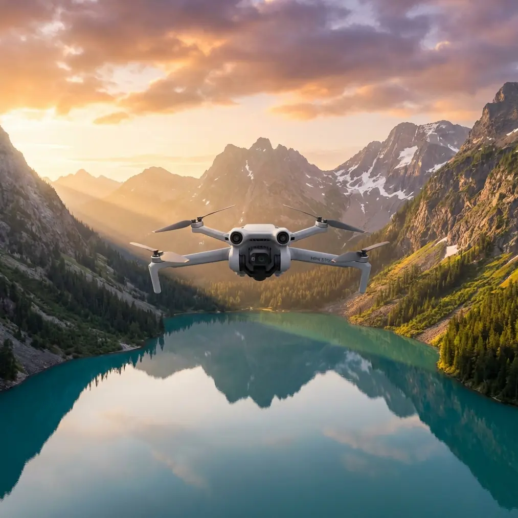
- The Air 3S dual primary cameras with f/1.8 aperture capture usable inspection footage down to 3 lux lighting conditions
- ActiveTrack 360° maintains subject lock on moving vessels, wildlife, or erosion markers even during complex flight patterns
- D-Log color profile preserves 13.5 stops of dynamic range, essential for high-contrast sunrise and sunset coastal work
Why Coastline Inspections Demand More From Your Drone
Coastal inspection work punishes equipment. Salt air corrodes sensors. Sand particles jam gimbals. Low-light conditions during golden hour—when erosion patterns and structural damage become most visible—push camera systems to their limits.
The Air 3S addresses these challenges directly, but only when operators understand how to maximize its capabilities in harsh marine environments.
This guide breaks down the exact workflow I've developed over 200+ hours of coastal inspection flights, from pre-flight preparation to post-processing optimization.
The Pre-Flight Cleaning Protocol That Saves Missions
Before discussing camera settings or flight patterns, we need to address the step most operators skip: systematic sensor cleaning.
The Air 3S relies on omnidirectional obstacle sensing across six directions. These sensors use a combination of vision systems and infrared detection. In coastal environments, three contaminants consistently degrade their performance:
- Salt crystal accumulation from marine spray
- Fine sand particles lodged in sensor housings
- Moisture condensation during temperature transitions
- Organic debris including seaweed fragments and bird droppings
- Sunscreen and oil residue transferred during handling
The 90-Second Cleaning Sequence
I perform this sequence before every coastal flight:
Step 1: Use a rocket blower (never compressed air) to clear loose particles from all six sensor arrays. Start with downward-facing sensors—they accumulate the most debris.
Step 2: Apply lens cleaning solution to a microfiber cloth. Wipe each sensor housing in circular motions, working outward from center.
Step 3: Inspect the gimbal motor housing for sand intrusion. A single grain can cause micro-vibrations that ruin footage.
Step 4: Check propeller attachment points. Salt corrosion here creates dangerous play in blade seating.
Pro Tip: Carry a dedicated "coastal kit" with cleaning supplies in a sealed waterproof pouch. I use a Pelican 1010 case with silica gel packets to prevent moisture damage to cleaning materials.
Mastering Low-Light Camera Settings for Coastal Work
The Air 3S 1-inch CMOS sensor with f/1.8 wide aperture represents a significant capability jump for inspection work. But automatic settings rarely optimize for coastal conditions.
Manual Configuration for Dawn/Dusk Inspections
When light drops below 50 lux, switch to full manual control:
| Setting | Recommended Value | Rationale |
|---|---|---|
| ISO | 400-800 | Balances noise against shadow detail |
| Shutter Speed | 1/60 minimum | Prevents motion blur during wind gusts |
| Aperture | f/1.8 | Maximum light gathering |
| Color Profile | D-Log | Preserves highlight/shadow recovery |
| White Balance | Manual 5600K | Prevents auto-shift during sunrise color changes |
| Focus Mode | Manual with peaking | Prevents hunting in low-contrast scenes |
Why D-Log Transforms Coastal Footage
Standard color profiles clip highlights aggressively. During coastal inspections, you're often shooting toward the horizon where sky meets water—a high dynamic range nightmare.
D-Log captures a flat, desaturated image that looks terrible on your monitor but contains massive latitude for post-processing. That washed-out cliff face? It holds recoverable shadow detail showing erosion patterns invisible in standard profiles.
The tradeoff: D-Log footage requires color grading. Budget 15-20 minutes per hour of footage for basic correction.
Expert Insight: When inspecting dark rock formations against bright sky, expose for highlights and recover shadows in post. Blown highlights contain zero data—underexposed shadows in D-Log can be pushed 3+ stops before noise becomes problematic.
Leveraging ActiveTrack for Dynamic Coastal Subjects
Coastline inspection often involves tracking moving elements: tidal patterns, vessel traffic, wildlife activity, or erosion progression markers.
The Air 3S ActiveTrack system uses machine learning to maintain subject lock through complex movements. For coastal work, three modes prove most valuable:
Trace Mode for Erosion Documentation
When documenting cliff erosion over time, place a high-contrast marker at your reference point. Activate Trace mode to follow the marker while you control altitude and distance manually.
This creates consistent framing across multiple inspection visits—essential for time-lapse erosion documentation.
Parallel Mode for Shoreline Surveys
Flying parallel to a subject while maintaining consistent distance produces the most useful survey footage. The Air 3S maintains lateral offset accuracy within 0.5 meters during Parallel tracking.
For beach erosion surveys, I track the high-tide line while flying at 15-meter altitude and 20-meter lateral offset. This captures both the immediate shoreline and sufficient inland context.
Spotlight Mode for Wildlife Monitoring
When documenting nesting sites or marine mammal haul-outs, Spotlight mode keeps subjects centered while you execute manual flight patterns. The drone doesn't follow—it simply keeps the camera pointed at your designated subject.
This minimizes disturbance while maximizing documentation quality.
QuickShots and Hyperlapse for Contextual Documentation
Raw inspection footage tells part of the story. Contextual shots establish location, scale, and environmental conditions.
QuickShots Worth Mastering
The Air 3S QuickShots automation handles complex camera movements that would require significant manual skill:
- Dronie: Pulls back and up from subject—perfect for establishing erosion site scale
- Circle: Orbits a fixed point—reveals 360° context around inspection targets
- Helix: Ascending spiral—documents vertical cliff faces efficiently
- Rocket: Straight vertical ascent—shows relationship between shoreline and inland areas
- Boomerang: Curved path around subject—creates engaging stakeholder presentation footage
Hyperlapse for Tidal Documentation
The Hyperlapse function captures time-compressed footage showing tidal movement, weather pattern progression, or light change across inspection windows.
For coastal work, Circle Hyperlapse around a fixed erosion point during a 2-hour tidal cycle produces compelling documentation of water interaction with vulnerable structures.
Set interval to 2 seconds for smooth playback. The Air 3S processes footage onboard, delivering stabilized 4K output.
Obstacle Avoidance Configuration for Coastal Environments
The Air 3S omnidirectional obstacle sensing system detects objects across all six directions. In coastal environments, this system requires specific configuration.
When to Modify Default Settings
Default obstacle avoidance works well in controlled environments. Coastal inspection presents edge cases:
- Tall grass and vegetation triggers false positives
- Water surface reflections confuse downward sensors
- Sea spray temporarily blinds forward sensors
- Rapidly approaching birds may not register quickly enough
Recommended Configuration
For experienced operators conducting coastal inspections:
| Environment | Obstacle Avoidance Setting | Rationale |
|---|---|---|
| Open beach | Bypass | Minimal obstacles, maximum maneuverability |
| Cliff faces | Brake | Stops before collision, allows manual repositioning |
| Vegetated dunes | Off (with extreme caution) | False positives make flight impossible |
| Harbor structures | Brake | Complex geometry requires conservative approach |
| Wildlife areas | Brake | Unpredictable animal movement |
Pro Tip: Never disable obstacle avoidance during low-light operations unless absolutely necessary. Sensor performance degrades in darkness—your safety margin shrinks precisely when you need it most.
Common Mistakes to Avoid
Ignoring wind patterns near cliff faces. Coastal cliffs create severe updrafts and turbulence. The Air 3S handles 12 m/s winds, but cliff-edge turbulence can exceed this locally. Approach cliff faces from the water side, not over land.
Flying with dirty sensors in "just this once" situations. Salt crystal accumulation is cumulative. That slightly hazy sensor today becomes a failed obstacle detection tomorrow. Clean every time.
Using automatic white balance during golden hour. The camera constantly adjusts as light changes, creating inconsistent footage that's difficult to color match in post-production. Lock white balance manually.
Forgetting to check return-to-home altitude. Coastal terrain varies dramatically. Set RTH altitude 50 meters above your highest obstacle—that cliff you flew past on the way out will end your drone on the way back.
Neglecting battery temperature in marine environments. Cold ocean air reduces battery performance by 15-20%. Keep batteries warm until launch, and plan flights with conservative power margins.
Frequently Asked Questions
How does salt air affect Air 3S long-term reliability?
Salt exposure accelerates corrosion on exposed metal components and can degrade sensor coatings over time. Implement a post-flight wipe-down with a slightly damp microfiber cloth after every coastal session. Store the drone with silica gel packets in a sealed case. With proper maintenance, coastal operators report normal lifespan from their equipment.
Can the Air 3S obstacle avoidance detect fishing lines or thin cables?
No. The obstacle sensing system cannot reliably detect objects thinner than approximately 10mm diameter. Coastal environments often contain guy wires, fishing lines, and antenna cables. Conduct visual reconnaissance before flight and mark hazards on your flight planning app. Never rely solely on automated obstacle avoidance near harbors or developed coastline.
What's the minimum light level for usable inspection footage?
The Air 3S produces professionally usable footage down to approximately 3 lux—equivalent to deep twilight. Below this threshold, noise levels compromise detail resolution needed for technical inspection work. For critical documentation, schedule flights during the 30 minutes before sunrise or after sunset when light levels remain adequate while shadows reveal surface texture and damage patterns.
Your Next Coastal Inspection Mission
The Air 3S transforms coastal inspection from a weather-dependent gamble into a reliable documentation process. Its combination of low-light capability, intelligent tracking, and robust obstacle sensing addresses the specific challenges marine environments present.
Success depends on preparation. Clean those sensors. Configure your settings before launch. Understand the limitations of automated systems in edge-case environments.
Ready for your own Air 3S? Contact our team for expert consultation.